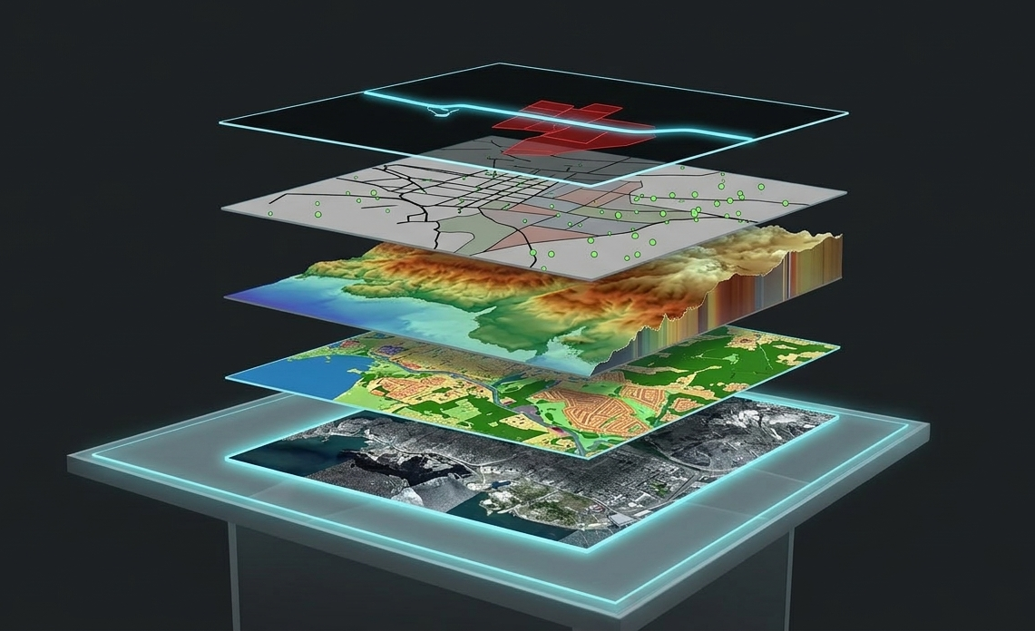
Geographic Information Systems (GIS) provide a framework for organizing, managing, and analyzing spatial data from a wide range of sources. By bringing survey data, utility networks, imagery, LiDAR, CAD files, and third-party datasets into a single geospatial environment, GIS allows information to be viewed, queried, and analyzed in a consistent and meaningful way.
GIS supports planning, analysis, and monitoring by helping clients understand relationships, patterns, and change over time, enabling informed decision-making across engineering, infrastructure, land management, and environmental applications.

Acquire and analyze satellite imagery to support large-area monitoring, land-use analysis, and change assessment where aerial or ground data is not practical.
Compare datasets over time to identify changes in land use, infrastructure, or environmental conditions in support of monitoring and planning.
Create interactive ESRI-based web maps and dashboards that allow users to visualize, query, and explore spatial data in real time.
Integrate Ontario Teranet Parcel information into CAD or GIS applications
Apply automated and AI-assisted techniques to classify land cover and extract features from imagery and LiDAR data at scale.
Convert and integrate CAD drawings, survey data, and third-party datasets into structured GIS formats to support analysis and long-term data management.
View, query and measure land information on our custom GIS application.
Connect to high resolution aerial imagery mosaic base layer served directly to your CAD or GIS application.
Search for geospatial data on our online data store, select files covering your location and quickly purchase with a credit card.