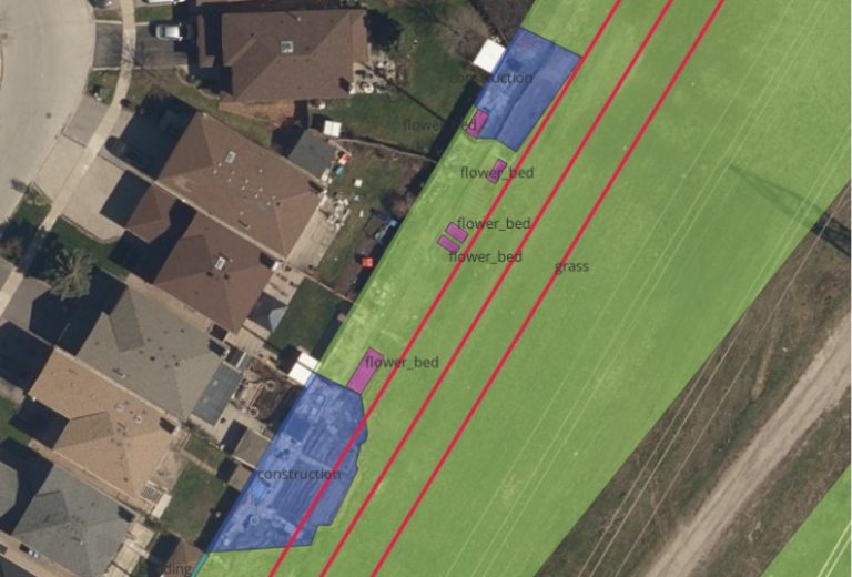
As land development accelerates, utility corridors face increasing risk from unauthorized encroachments that can obstruct access, damage infrastructure, and compromise public safety. J.D. Barnes, First Base Solutions, and OnSite Locates leverage high-resolution aerial imagery and artificial intelligence to help utility owners proactively monitor and protect their assets.
By combining wide-area aerial collection with AI-based feature detection, potential encroachments such as structures, excavation activity, and land disturbances can be identified early and reviewed by professionals. This approach improves access for maintenance and emergency response, reduces inspection costs, and supports year-over-year change detection to track evolving risks and development activity across utility corridors.